Category 5 Hurricane Polo Explodes in Strength Off Mexico as Pacific Threat Intensifies
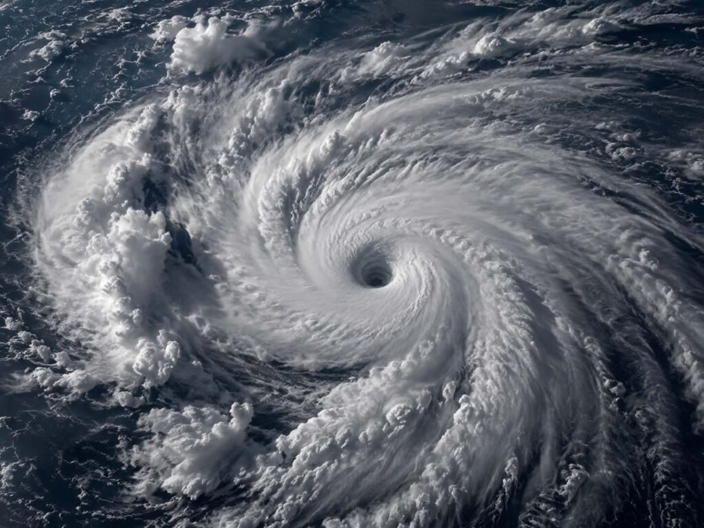
Hurricane Polo rapidly intensified into a Category 5 storm Tuesday off Mexico’s Pacific coast, becoming one of the strongest hurricanes of the 2026 Eastern Pacific season and prompting warnings about potentially life-threatening flooding and mudslides.
Polo reached Category 5 strength with maximum sustained winds of about 160 mph, according to the National Hurricane Center. Later observations indicated winds had increased further, with the storm continuing to strengthen while remaining offshore.
The storm’s rapid development has attracted attention because Polo went from a tropical storm to a Category 5 hurricane in roughly 24 hours. Despite its exceptional strength, the current forecast calls for the center to remain over the Pacific rather than making a direct landfall in Mexico.
Polo Rapidly Intensifies Into Category 5 Hurricane
Polo underwent an unusually rapid strengthening episode as it moved near Mexico’s southwestern coast.
On Monday, the system was still a tropical storm with winds around 45 to 50 mph. By Tuesday, it had intensified to Category 5 strength, the highest classification on the Saffir-Simpson Hurricane Wind Scale.
The National Hurricane Center reported maximum sustained winds of 160 mph at one point Tuesday, while later observations put the storm’s winds even higher. Additional fluctuations in intensity remain possible.
Category 5 hurricanes have sustained winds of at least 157 mph, making Polo an exceptionally powerful tropical cyclone.
Storm Remains Offshore of Mexico
Polo was located roughly 220 miles south of Zihuatanejo and about 360 miles south-southeast of Manzanillo during the National Hurricane Center’s Tuesday morning advisory.
Forecasters expected the storm to turn northwest and then west-northwest, continuing to move slowly near Mexico’s Pacific coast.
The current forecast does not call for the hurricane’s center to make landfall. However, its proximity to the coast means that dangerous rainfall and tropical-storm conditions remain possible even without a direct strike.
Southwestern Mexico Faces the Immediate Threat
The most significant impacts are expected along portions of southwestern Mexico.
The National Hurricane Center warned that heavy rainfall could produce life-threatening flooding and mudslides, particularly in mountainous areas.
Forecast rainfall totals included roughly 4 to 8 inches across parts of Guerrero and Michoacán, with locally higher amounts possible. Additional rainfall was expected in coastal portions of Oaxaca, Colima and Jalisco.
Authorities have urged residents in affected areas to monitor official warnings and avoid flooded roads and waterways.
Tropical Storm Watch Issued
A tropical storm watch was in effect for portions of the southwestern Mexican coast, extending from Tecpan de Galeana in Guerrero toward Manzanillo in Colima.
A tropical storm watch means tropical-storm conditions are possible within the specified area, generally within the following 48 hours.
Forecast changes remain possible because Polo is moving relatively slowly near the coastline. Even a modest change in its track could alter rainfall totals and the areas experiencing the strongest winds.
Why the Storm Has Become So Strong So Quickly
Polo’s rapid intensification has been one of the defining characteristics of the storm.
Meteorologists use the term rapid intensification when a tropical cyclone’s maximum sustained winds increase by at least 30 knots in a 24-hour period. Polo exceeded that threshold by a substantial margin as it strengthened from a tropical storm into a Category 5 hurricane.
Warm ocean water and favorable atmospheric conditions can allow tropical systems to strengthen quickly, although the precise combination of factors behind any individual storm is assessed by forecasters as new observations become available.
What About the United States?
Despite headlines warning Americans about the storm, the current primary threat is not a direct hurricane strike on the continental United States.
Polo is located off Mexico’s Pacific coast, and the National Hurricane Center’s forecast keeps the storm’s center offshore over the coming days.
That does not mean there can be no effects farther north. Large Pacific hurricanes can generate dangerous ocean swells and rip currents well away from their centers, and forecast tracks can change.
However, there is currently a major distinction between monitoring a powerful Pacific hurricane and warning that millions of Americans face a direct Category 5 landfall.
Other Pacific Activity
Polo is not the only tropical system being monitored in the Pacific.
The National Hurricane Center was also tracking Tropical Storm Odalys farther west in the Pacific. Odalys had maximum sustained winds around 65 mph and was forecast to strengthen further, potentially becoming a hurricane.
The combination of multiple active systems makes continued monitoring important, particularly for maritime interests and communities along the Pacific coast.
Polo Is the Latest Major Pacific Hurricane
Polo is among the strongest hurricanes recorded in the Eastern Pacific during the 2026 season.
The storm follows other major Pacific hurricanes earlier this year, including Genevieve and Lowell. The Eastern Pacific has been considerably more active than the Atlantic Basin so far this season.
The storm’s Category 5 intensity is significant, but wind speed alone does not determine the ultimate damage from a hurricane. Track, rainfall, storm surge, terrain and the amount of time a storm spends near land can all substantially affect impacts.
Forecast Could Still Change
Polo’s future track remains an important variable.
The hurricane is expected to turn away from its current eastward movement and head northwest and west-northwest. Forecasters expect the center to remain over the ocean, but the storm’s outer bands can still affect coastal areas.
Because Polo is moving relatively slowly, rainfall could persist over the same areas for an extended period, increasing the potential for flooding and mudslides.
Residents in southwestern Mexico should therefore continue relying on the National Hurricane Center and local authorities for updated warnings rather than relying on older forecasts or social-media posts.
What to Watch Next
The most important developments over the next several days will be:
- Whether Polo maintains Category 5 intensity;
- How close the hurricane’s center comes to the Mexican coastline;
- Whether additional tropical-storm watches or warnings are issued;
- Total rainfall across Guerrero, Michoacán and neighboring states;
- The potential for flooding and mudslides in mountainous areas;
- Whether the storm’s forecast track changes significantly.
For now, Hurricane Polo is an exceptionally powerful Category 5 hurricane posing its most immediate threat to southwestern Mexico. The current U.S. forecast does not indicate a direct continental U.S. landfall, making the claim that millions of Americans are presently facing a direct hurricane threat misleading.

Benjamin Harris is a RapidReports front page contributor and editor,proud father of four.